Sunday, April 5, 2015

Apu Ausangate

We rise up from Cuzco to arrive in the Andean valley town of Tinke. The Mamitas wear traditional flat hats and wool dress, and the men dress in work clothes that look like they come from Chinese fashion shops. It's a functional style, made for the elements and obtained from what's at hand, and the people are attractive. On most days there are sheep being slaughtered in the streets, vegetables and cuy being sold in open markets - the feeling all around is electric, alive and beautiful. People smile and speak in Quechua. From this view it's hard to tell, because you can't yet see, that behind this authentic scean in an Andean town there is a chain of mountains so tall and so imposing that you might lose your breath for a moment if you could. It is Ausangate: the sacred apu, sacred mountain. The impact is palpable to anyone who sees them, and you don't have to be spiritual to see how these mountains give life. The glaciers cloaking these towering 7500m peaks feed the rivers that flow through the highlands and into the amazon basin. These mountains make weather systems. It is something enchanting to be part of the mix that pulses alive with sunlight, cloud, water, rock, and tradition. Once you rise higher still to the mountain villages you will be surrounded. The landscape changes. And the people who live here are like any others, they wish their children a bright and good future. Being alpaca herders, weavers, and potato farmers means that the subsistence based economic life of the villages here gives everyone ties to the past, though the recent influx of tourism to the area has brought with it new ideas, new languages and new opportunities. Where in the last decades this area has seen an outflow of people searching jobs elsewhere, now there are opportunities literally coming to there doors. Usually travelers come here to hike the mountain circuits, or to offer despachos around the lakes and mountains, but then they find themselves staying for the beautiful hospitality and the hot thermal waters that help life in this cold, high place relax and stay warm.

We immediately felt inspired when we came in December 2014. And supporting culture that protects the environment and preserves language and tradition are important values in my work with sustainability initiatives. On our second visit we organized a community meeting in Pacchanta. They are eager for opportunities that can help them make good choices and develop sustainably, as well as keep jobs in the community. We are going back in the end of April to begin strategic planning with them, and keep developing our friendship and partnership. Together we will organize and move forward together, slowly and carefully, to be able to keep developing, promoting and valuing the kinds of opportunities that help keep the environment and culture vibrant, authentic and healthy. English-Quechua language exchange, traveling health clinics, home-made soap and environmental care initiatives, hot-houses for food and nutrition diversification with high-elevation maca trials, as well as slow-tourism are all possibilities we have thought of. Together, who knows what else could be. For now we go slow, in awe of the beauty and kindness here. If you're interested in taking part, let us know.

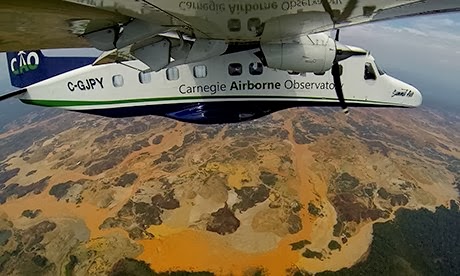
Here are some pictures from our time. More can be found at https://www.flickr.com/photos/128435253@N07/with/16786744790/


Thursday, February 27, 2014

Gold Beneath the Surface

You might never guess it after seeing the pop-up towns, quickly made from tarps and scraps, or from noticing the kilometers of dead trees and upturned soil.
Nor would you be able to conceive of how large it was, nor how much land is being cleared, nor how fast.
But it is there: 
Gold is beneath large parts of the Amazon rainforest. 

I didn't really understand the scale until I looked more into it. 
Last week, Juan and I drove the Inter-Oceanic Highway which leads from the Pacific ocean to the Atlantic. It crosses the desert, the Andes and the jungle. Our portion of the route was from Cusco to Puerto Maldonado. Our goal was to get a better sense of illegal gold-mining in southern Peru. 

After we passed 4700m above-sea-level high in the Andes, we began our decent down through the cloud forest leading to the Amazon rainforest. We stopped in the gold-mining town of Quincemil, where we walked into the forest to meet miners and see their projects. There, however, we only met the big machines, fancy cars, and the knee-deep mud of the roads which lead out to the open-pit mines. In Quincemil we realized that some of the mine projects scattered along the 800km stretch between Cusco and Puerto Maldonado are sometimes only reached with up-to-a-day's travel, or more, away from any highway. They are edging-out in every direction.

When we entered the car again after Quincemil to finish the miles towards Puerto Maldonado, Juan passed me his Nikon camera and I sat in the front seat snapping pictures as best I could from the moving car. These are some of the photos I collected.

Meeting knee deep mud, we couldn't continue like the specially built mining trucks could. Not without boots! Here the road towards the gold-miner's settlement begins. The local land owner said it is about a day's trek to arrive. 

At first the skeleton trees seem normal, until you realize that the clearing of land is for illegal gold mining. The resulting loss of ground water and mercury pollution is killing them. This patch is a very small one. Deeper in, away from the highway there are thousands of hectares like this.
On the rivers lead from the high glaciers of the Andes, gold miners start to rip-up the banks of the Marcapata River, which eventually runs into the larger Inambari & Madre de Dios rivers.
The broken river banks add to the silt in the rivers which clogs river life, not to mention mercury pollution. There are places where the river is so silted that it is possible to drive cars on the river.
Settlement: "KM107".
Settlements made of tarps, scrap wood and metal have been popping up along the highway. Four years ago this place didn't exist. Thanks to the construction of the Inter-Oceanic Highway, it now exists completely for gold mining as more migrant works come to strike part of the fortune and disaster in the jungle gold mines. With the people come more pressure on wildlife for bushmeat, as well as intense social problems. The settlement, not found on any map, is simply called "KM107". It is one of several settlements which exist between the kilometer markers 117 and 92. The area of strip gold mining goes out for many kilometers in all directions, especially towards the Tambopata Reserve. 

But what we could not fully see so obviously from the highway is what you can fully see from the air.
For the first time the extent of illegal gold-mining in Madre de Dios, Peru has been mapped using aerial techniques.


An area of gold-mining destruction thousands of hectares in size (Photo credit: Carnegie Institution for Science).

The impacts of these mines are felt, seen and heard everywhere around Puerto Maldonado - for example, socially the last few years have felt the rumbling effectsWealth distribution and political direction has been affected. We have seen monthly strikes from gold-miners in response to low gold prices. The strikes can close the food-market in fear of riots. More tragically the deaths and injuries which have resulted from miners in clashes with police in 2012 (of course there have been other clashes both before, and after as well). The illegal mining has also brought a lot of other social crimes, including sexual exploitation and slave-labour.

From a health perspective, it is estimated that there are more than 650 tonnes of mercury released yearly in to the air and water-courses within the Madre de Dios region. Mercury is highly toxic in any form, and affects the kidneys, gastrointestinal tract and nervous system systemically. Recent studies on mercury from the gold mining here in southern Peru found that the amount of mercury outside of local gold-trader shops, vaporized as gold chunks are melted to be sold, is 22X than the World Health Organization's recommended exposure level. But from a public perspective, the effects to the non-mining community are less widely known by the locals. For example, many believe that the mercury which enters rivers and waterways merely sinks to the bottom, where it will stay. The fact is: it is poisoned ground.

The ecological impact is much more tangible. Immense swaths of disturbed land can be seen from the air. You can see the work of the Carnegie Airborne Observatory, who flew over the open-mine of Guacamayo, Madre de Dios. This video includes commentary in Spanish.

For us at Canto Luz, we have been seeing this as is a very serious issue. Canto Luz is situated on the Rio Piedras, which is as of yet, a river with no gold-mines upstream from us. We take pride in our clean drinking water, our excellent neighboors, and that we can swim safely in the river. Our forest is intact, and something we are not taking for granted. We also know this affects the whole world from an ecological and health perspective, and we are working in land-protection issues as one of our key efforts.
It is all very close to home.

This aerial map from the Carnegie Landsat Analysis System-Lite has mapped small mining operations in Madre de Dios between 1999 and 2012. Each of these colored spots can represent a mine up to 10 meters deep.
Many meters deep, a boy stands in front of a clandestine gold mine pit. These small pits have mud and debris which are transfered into an oil drum with added mercury. "Someone stands in the drum and starts jumping up and down" to coagulate small pieces of gold. It is hard to imagine. Photo credit: New Yorker.


If we work with our neighbours, and particularly the ones who are not currently involved in gold-mining and rather work instead with brazil-nut harvesting and wood-sales, we can make a plan to sustain people and protect nearly 10000 hectares of forest. Canto Luz alone has access to 600, and along with others in the Baja Piedras land-owners association and our neighboors with over 4000 hectares, we care about finding alternatives to illegal gold mining.

Last year the Peruvian Environmental Protection Agency elaborated a plan to pay land holders to protect their land - but sadly, the office in our area has closed for money issues, and the plan has not followed through. We need alternatives to goldmining in this region - because once the land is taking and mined, it is useless for everything. As scientific agencies report, the reality is setting in, "50,000 hectares of forested lands and alluvial areas have been affected by unregulated mining, transforming huge swaths of the Peruvian Amazon into barren wastelands". There is no future where lands have been mined.

Our initiative, which is only just beginning, involves more stable income generation through tourism, agroforestry and more-sustainable logging. With the locals expertise and dreams, we can use our organizational powers to build capacity towards these kinds of activities which already have a footing here. We will partner with other organizations, neighboors and native communities towards this end. Some of our neighbours, including Bocaparia Manu, are working towards it already. We already have good relationships with Puerto Arturo and Bocaparia Manu, and are working on creating a working relationship with Santa Teresita, who we donated 200 hectares of our land to. With the Baja Piedras Association, a group of 60 small and large-sized land holders we will be looking at what we can do to work towards a more sustainable future.

It's a lot of work, and I don't know where it will take us.

But there is gold beneath the surface,
and we want to keep it there.


Tuesday, January 28, 2014

Rain to the River. River to Rain.

Rio Madre de Dios, in the "drier" season.
Where I stay while we're in the city from the jungle, I saw the lightening.
Seen from afar on the roof-top terrace of Juan's house , it seemed like the rays were active up 100km from the surface of the earth. Flashes illuminated the sky for hours, and we watched it coming from the west thinking it would arrive any minute.
It didn't. Not then.
It's the rainy season in Madre de Dios. This means that you can reliably expect some rain -
But, in which form? For how many days? With sun? With electrics? - All of those answers are not so reliable. The guess on reality seems to be a bit more of a gamble. It could never stop raining for weeks. Or, a storm may never arrive, and instead circle and circle. But being surrounded by the largest tract of tropical rainforest on all of earth where we are situated on one major river that is part of the Amazon drainage system - the amazon with it's delta mouth 240km in width from bank to bank ...

....you reliably expect water peeing endlessly from the sky, none-the-less. It's just a matter of when

Those clouds, with lightening and thunder dancing in the atmosphere, were huge.
Really though, nothing special for this part of the world.
But still so huge that the storm was actually probably still 150km away when we saw it. But if you didn't count the seconds between flashes and booms, you would think it was going to be over your head in a few minutes. I did, at least.

But it was not a few minutes,
No, it was hours before it actually arrived, and it came in the night.
I was able to sleep only until that thunderous collection of moments when rain exploded into the roof.

The house's floor flooded. Water soaked down through the windows (I was before wondering why the paint was peeling in all the rooms). Rain blew in the side crevices, left and right. And while water fell down, puddles on the ground simultaneously soaked upwards. The storm flowed in all directions: water wicked through the ground, and rain pummeled through the sky.

No big deal though - 12mm of rain over about 8 hours.
Like I said, it really wasn't anything special. In India they can get 120mm in a day.
It was not some "storm of the century". Nor an event really out of the ordinary.
Sure, it might have collapsed the highway between here and Cuzco.
But really, that is just nature's way.

So the rivers rise.
Madre de dios in partial swell (wikipedia)
But it can go higher still.
A part of Puerto Maldonado in 2003.
I would love to see a picture of the full-size of the Madre de Dios
(dailymail)


But me, being from a dry little corner of the world (but where we still do get our own share of floods)... I was extremely impressed with the amount of water. And since all the water needs to goes somewhere - in a city without out many storm drains - the rain meanwhile took dry ground, and garbage, and the banks of the ports out to the sea with it.

Those waters in the rivers, and those waters of the sea mix with the great life-force of this living jungle and keep it all raining again. Rain to river. River to Rain. An Endless loop.

I hope.

Yesterday, we couldn't get back to Canto Luz (which is situated a few hours outside of the city, up river), because cars couldn't get to the port where our boat is. But had we been with boat, I am sure I would have felt the raw awe again of river travel : those immense possibilities that, if I flowed, would all take me to the other side of the continent.

approximately where Canto Luz is, along the river piedras,
a tributary to the Madre de dio
(canto luz)
No wonder it is so green here.


but more on that soon - And my life in just a small snippet in the amazon basin.
huge mother-lovin' basin 


Meanwhile, read Canto Luz' blog- http://www.cantoluz.com/#!blog/cdch


Wednesday, January 8, 2014

Some Visuals from the Vision

The strangler fig crawls to slowly envelop trees
that it will soon become. Here it looks like its walking

 What a journey it has been - now almost exactly 3 months in Ecuador, I am awaiting the next half of my half-year here: my ticket for Peru has me leaving in just 36 hours. I have had two weeks resting in the mountain valley near Cuenca, where the villages of Vilcabamba and Javier Loyola have helped me recharge my batteries (literally), and wash of the jungle smell from my clothes.

While the journey ahead mystifies me, I can look back fondly on my internship here, which lasted from mid-October to mid-December. Through my time in the Jama-Coaque ecoreserve, I was able to meet other people from projects in the Ecuadorian province of Manabi. We visited a small farm called Finca Mono Verde, as well as the very well-advertized "Rio Muchacho" which is a community-based organic-farming school (that coincidently is also for sale for $400000 if you fancy). There really are few organic producers in Ecuador, and even fewer working with priniciples related to ecology, so it was a gift of meeting the director from the sustainable agricultural department at the University of Calceta - Servio - who has been living on the same piece of land for 4 generations, and has the most fantastic examples of small scale food forestry. Luckily we also met his 110 year old mamey tree and mango trees. Beyond his work collaborating in sustainable agriculture around the country, his personal project is now focused on making high-quality, hand-picked cacao beans grown from heritage trees in the goal to have fair trade, organic chocolate bars crafted from tree to package. Sadly, I didn't take my camera out for this visit - which is a little bit of a bummer, because of his picturesque mango tree-houses, beautiful clean river, and his host of low-impact, traditional technologies like the old-style hand-carved cane press and a small-scale cacao fermentation chambers. He grew all his own corn, rice, animals, fruits, chocolate, coffee, sweet potatoes, and many of his own vegetables. MAGIC!

This is a stake of roof-tiles, made by hand from the cade-tagua palm.
It's a laborious process that can only happen during the waning moon. 
Truly, it is too bad I am not the most diligent in remembering to take pictures, but I try as best I can. Here below you can see some of the selected ones, showing some highlights in my training in the program at the Jama-Coaque reserve in the coastal cloud forest of Ecuador. As well as few from the projects we've visited. 

Please enjoy! 

This was a stingless-bee hive made by a previous intern. It was a bit off in the calculations, and built for the wrong type of bee, but it has been lived in none-the-less - just with a different entrance! There is a small block of wax on the top of the box, which was one of my attempts to make a wax candle. But there is something different about stingless-bee wax,  as it has different properties. It might not burn well without clarification, but it is still strongly medicinal, being a anti-bacterial conglomerate of several different life giving plants from around the forest. 


Growing food in the disturbed area, surrounded by jungle is not the easiest undertaking - both leaf-cutting ants and the introduced african snails lay fast waste to tasty garden morsels. However, there are a few superfoods here that actually grow like weeds, despite the onslaught of insect taste-buds. Here is malibar spinach, an iron rich spinach alternative used a lot in India. Local varieties are the precursor to amaranth, and a funny looking cucumber called achogcha - which is delicious stuffed. Well we could never grow enough of the more well-known vegetables like brocoli, we still had a small supply of these good supergreens, chayote and yucca root. Luckily we didn't starve though - there was always the weekly shopping trip. But the future shouldn't be as dependent on the town tiendas, as we have over 100 trees of 30 different species of fruit, nut and spice trees within the production zone. We are still waiting for a few more years until they mature, and provide a bounty so diverse, it will be hard to keep up as it ripens! 


a view of the cathedral in the cloud forest -
an ecosystem completely threatened
One of the works of this past session was construction
of an earthen bag wall. 
A view from the top of the ridge, in the cloud forest. This view shows the predominant pattern on the coast, which is the loss of forest. Here you can see cattle pasture, which hardly supports the cattle. They were extremely emaciated - it is hard to imagine making a balanced-living from that... still, I find the contrast disturbingly beautiful.
What picture album is complete without a
spiralling forest dweller? 

the forest has so many layers

A Jama-Coaque artist, who has been working with his ancient lineage's practice of pottery. The Jama-Coaque region has a rich amount of pottery pieces, and ornate sculptures. Amongst archeology and recreations, he also does giant fun sculptures in the local town. This is a 20m long iguana!


I did a lot of work revitalizing the terraces using the native bamboo. This are very heavy pieces!

Two of our kitchens running in front of pineapples, and the banana circle, where the grey water runs out towards.

The Jama Coaque house is a mansion of epic-bamboo-ness. This house can sleep over 20 people.

Some of the hot-chilis that grow like weeds in the production zone.

This is a solar dehydrator that works pretty well for some things. It doesn't keep the cockroaches out and could work even better with a re-design... but, the handy part is how moveable it is.

one of our efforts at growing some starts - normally they disappear anywhere outside of our balcony garden... mysteriously! Even this covered box is not safe from the 1000's of insect species that live around us.

Utilizing the space underneath the house, we were able to have a lot of extra stations. Here is some of the tools we work with, and you can see a part of my tomato hanging project (tomatoes do not last here very long before something discovers them!)

A mounted bicycle, to be used in bicycle powered processes, whether it be milling food, running a small generator, or pumping water.

Our brick oven - mmmmm, pizza!
I have never eaten (quite happily!) so many bananas in my life. They grow all over the jungle, as remnants of the settlers who used to live in the valleys. 

The view, while I contemplated working, is sincerely expansive and fantastic
We ate a lot of fresh food; local vegetables and tropical fruits

Some of the patterns of the forest amazed me. There is a likeness to the transdimensional visions that humans receive sometimes, no?

Jerry, director of TM Alliance, using a machete to open heritage cacao seed-pods from 100 year old cacao plots. We are going to plant the seeds!
Here Reserve Manager Jordan poses with our 400 planted fundas of heritage cacao seeds. They will germinate in about 7 days. We have agro-forestry plots out in zone 3 of our forest.
Here in the foreground is the poor quality of soil in the landscape outside of the reserve. In the background is forest, but in the midground is the smoke from agricultural fires. Locals use "slash and burn", a method that quickly turns vegetation to plantable land. But the problem is it also quickly turns the land barren, and requires a lot of inputs to keep it fertile. This kind of agriculture has been practiced for a long time, but it is by no-means the best kind for landmanagement. A more ecologically minded kind would be "slash and rot", which takes a lot more time, but leaves valuable topsoil.


One of the many types of orchids that live in the jungle. The diversity of this family is mind-boggling.


Part of the mission of the Third Millennium Alliance is related to reforestation.
In a converted cattle pasture, landscaped to contour lands, there are over 8000 native hardwood seedlings planted. Here are 8000 new seedlings, which will be planted in January 2014. The plan is to use principles of eco-forestry to maintain forest cover, but produce a small income from a more sustainable logging method.
The tropical jungles have poor top soil, as most nutrients which are found in the top soil are quickly converted into plant growth. In the production zone, we built an in-situ compost pile (called sheet mulching) to work the soil and build it up for vegetables. Getting all the manure in was done by hand, and we gathered it by nearby cattle. 
We lived in bamboo mansions. Here is the casita, a two-level house on stilts (at the back),
and our composting toilet (in the front). Dry composting toilets are an important part of waste and water management, especially in rural areas without plumbing. 
A permaculture-designed system at Rio-Muchacho.
Guinea pigs live in the red-houses, and their poop falls
into worm composting bins. These bins are rotated,
and the soil is used for a plant-nursery. In the foreground,
you can see part of the circle from pig-waste-composters.
These circles are an ingenious design from the founders
at Rio Muchacho, and make gold for them! They've
found that the price for composted manure is even
higher than for the pigs themselves.
Here is more detail from the pig waste circles. They are dug down and filled up each day as the pens are cleaned. In total there are 3-circles.
A three chamber solar dehydrator at Rio Muchacho. One slider on top,
one in the glass pane, and the last in the tray-ed box.
Servio poses beside the newly built cacao fermentation chambers. It should be enough for several hundred kilograms of chocolate.
A cathedral of San Pedro in Vilcabamba valley.
Land-stewardess at Huilco Way, a farm in Vilcabamba. She has been working all over the
 world for over 30 years with the concepts of eco-agriculture, and permacultural design.